 |
||||||||


A Bird-Eye View of Tampa Bay's Eastern Shoreline
Stretching from shoreline restorations at the Port of Tampa to pristine aquatic preserves north of the Manatee River, a 20-mile corridor of preserved lands borders Tampa Bay's eastern shore. "It's not completely linked, but it's pretty close," says Brandt Henningsen, chief environmental scientist for the Southwest Florida Water Management District. "There are some breaks but it's an amazing accomplishment and a true legacy. A hundred or two hundred years from now, people will look at this land and realize how wise we were to set it aside while it was still available."
Scroll your mouse over each tab for more information on the preserve.
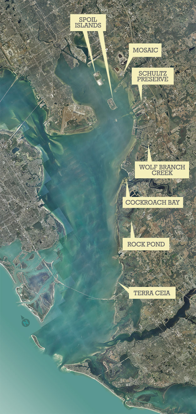
Click here for a large version of the map.
Other stories on properties on the eastern shore of Tampa Bay include:
- Emerson Point Preserve in Manatee County, Fall 2002
- Newman Branch Preserve, Spring 2005
- Robinson Preserve, Summer 2006