 [/su_frame]
USGS asks citizen-scientists for help tracking coastal changes
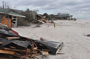
Sometimes even the most powerful computers can’t do a job as well as the human brain. That’s the case with aerial photographs taken by the U.S. Geological Survey to track changes in coastal conditions after storm events.
A new crowdsourcing application called “iCoast — Did the Coast Change?” harnesses the power of citizen-scientists around the world to compare changes and help improve predictive models of storm damage.
“Computers cannot yet automatically identify damages and geomorphic changes to the coast from the oblique aerial photographs,” said Sophia B. Liu, USGS Mendenhall Postdoc Fellow. “Human intelligence is still needed to finish the job.”
Without the personnel or capacity to analyze all the photographs taken — more than 140,000 since 1995 — the crowdsourced app allows citizen-scientists to help identify changes to the coast while also gaining knowledge about coastal hazards.
Analyzing the aerial photographs to identify storm damage will help coastal scientists refine their predictive models of coastal erosion and damage caused by extreme storms. Currently, these mathematical models are derived from dune elevation and predicted wave action during storms. Adding the human observations will allow the scientists to validate the models and to provide better predictions.
Learn more and download the app at http://coastal.er.usgs.gov/icoast/
[su_divider]
BASIS 6 set for 2016
Although details have not been finalized, organizers have started working toward the sixth Bay Area Scientific Information Symposium (BASIS) to be held later this year. A 3-day conference, it brings together scientists, bay managers, citizens and students to share the latest information and trends on the bay’s health. It is typically held every five or six years.
The first BASIS, held in 1982, called for the creation of the Tampa Bay Management Study Commission, which became the Agency on Bay Management in 1985. ABM, in turn, helped to create the Tampa Bay Estuary Program in 1990.
The TBEP, which developed its first Comprehensive Conservation and Management Plan in 1996, is revising the document that guides regional bay management and restoration activities, with final adoption of the updated “Charting The Course” expected in late 2016.
“Issues like sea level rise that weren’t even considered when we wrote the first CCMP have become priorities,” said Holly Greening, TBEP executive director. At the same time, water quality goals that were intentionally set high have been achieved in most bay segments.
“This is a good time for us to rethink water quality targets,” she said. “We could get clearer water which might support additional seagrass growth, but water with less algae might limit the number of bait fish, which are an important food source for birds and other fish in the bay.”
For timely updates on these activities, follow Bay Soundings on Facebook or join the e-newsletter list at tbep.org.
[su_divider]Ocean current energy test site approved
Small-scale turbines will soon be tested off Broward County in the world’s first offshore initiative as part of a partnership between Florida Atlantic University’s Southeast National Marine Renewable Energy Center, the U.S. Department of the Interior’s Bureau of Ocean Energy Management, the state of Florida and private entities.
“This project is a potentially paradigm-shifting development in the global quest for clean energy sources and puts South Florida at the forefront of research in this critical effort,” FAU President John Kelly said.
The test berths, each consisting of a buoy anchored to the sea floor, allow ocean current turbine prototypes (up to 100kW generation capacity) to be deployed from vessels moored in the Gulf Stream for a few weeks at a time.
“The Gulf Stream contains a tremendous amount of energy, and this technology offers exciting potential to expand the nation’s renewable energy portfolio,” said Walter Cruickshank, BOEM acting director.
Industry partners will have the opportunity to evaluate the efficacy of their turbine designs while mooring buoys collect measurements of ocean conditions nearby.
[su_frame align=”right”][/su_frame]FAU has been working since 2007 to establish the test site. Researchers recently performed a successful final sea trial of the first test berth buoy as well as preliminary tow tests of a small-scale research turbine in late 2013 — key steps before the installation of the test site. Additionally, an environmental assessment of the project concluded that “no significant impact” was expected.For more information, visit http://snmrec.fau.edu.
[su_divider] [su_frame align=”right”] [/su_frame]
Golden Mangrove Award honors spring, lake restoration efforts
The rejuvenation of a neglected natural spring along the Hillsborough River in Tampa and the restoration of a canal leading to a residential lake near the Florida State Fairgrounds were co-recipients of the Golden Mangrove Award as outstanding Bay Mini-Grant projects by the Tampa Bay Estuary Program.
Ecosphere Restoration Institute, led by Tom Ries, was honored for the comprehensive Ulele Spring project that reconnected a long-forgotten spring near downtown Tampa with the Hillsborough River to provide a quiet refuge for manatees. (Learn more at http://baysoundings.com/urban-oasis-for-manatees-under-construction).
The East Lake Park Homeowners Association, led by Hal Hart, restored a canal leading to this highly modified lake just east of Tampa. More than 800 volunteers removed invasive plants such as water hyacinth and hydrilla and replanted the canal shoreline with 2,300 native aquatic plants to help filter stormwater before it reaches the lake.
“This grant cycle was a banner year for exemplary Bay Mini-Grant projects,” said Kristin Lehman, chair of the Golden Mangrove Award committee. “The two projects are drastically different in scope and reach but they both are outstanding in their own right.”
Funding for Bay Mini-Grants comes from sales of the Tampa Bay Estuary license plate.
[su_divider]