Sea-level rise looks just a little different from the top of the observation tower at Weedon Island Preserve.
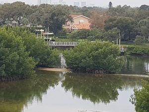
When scientists predict a 2- to 8-foot rise in sea level over the next 80 years, it’s easy to see the impact from 50 feet up. To the south, just visible past a lush mangrove forest, is a row of waterfront homes.
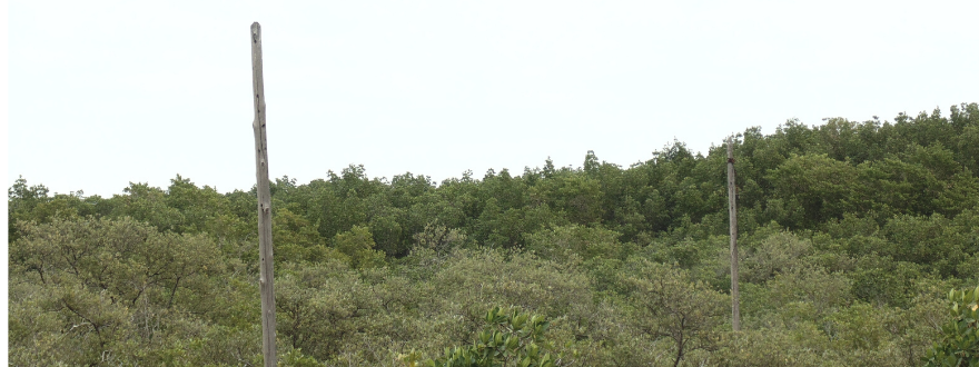
In addition to homes, habitats bordering Tampa Bay. Dead trees tower the mangroves, probable victims of climate change. A nearby salt barrens has visibly shrunk over the past 10 years as rising waters nibble away at one of the region’s rarest habitats.
And the healthy mangrove fringe that protects the low-lying island from erosion is being undermined as higher waves wash away the sediment they had collected.
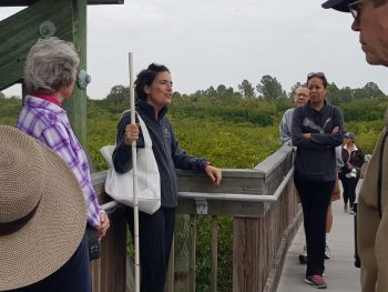
“We really wanted people to see the local impact of sea-level rise, not just what is happening to polar bears in the Arctic,” said Libby Carnahan, the Florida Sea Grant agent for Pinellas County who has organized a series of “Climate Walks” this spring. “It’s important that people know what is happening to wildlife in Tampa Bay — what rising tides are doing to the habitats that birds, fish and other animals depend upon.”
A diverse group of people joined her for the first Climate Walk in January. Some were members of the Sierra Club or master gardeners. Others were visitors from places like Wisconsin who came to learn more about how climate change is impacting Florida. Others were interested residents from across the region who wanted to learn more about the specifics of sea-level rise so they can educate their friends and neighbors.
And while polar bears and melting snowcaps often make headlines, small increases in sea-level are already impacting the local communities and ecosystems around Tampa Bay. The St. Petersburg tidal gauge has recorded an increase of 7.8 inches since 1946, with the most recent readings showing the most significant changes, according to Carnahan.
That may not seem like much of a rise, until you consider how this impacts local drainage in communities. Stormwater outfalls built decades ago are becoming encrusted with oysters, a clear sign that they are inundated with saltwater more frequently and for longer periods.
A founding member of the Tampa Bay Climate Science Advisory Panel (CSAP), Carnahan is on the front lines of research as well as ground-truthing changes already happening outside her Weedon Island office.
“People have occupied Weedon Island for 1,100 years, but they were probably nomadic and could move to adjust to changes,” Carnahan said. Adjusting to change today becomes a “swirling circle,” in which models predict the future, feedback is accepted as the changes occur, the science is reassessed and plans are updated.
Local governments are developing plans to increase community resilience to climate change, and are working together through the Tampa Bay Regional Resiliency Coalition. Coordinated by the Tampa Bay Regional Planning Council, the coalition currently includes 29 local governments.
The different scenarios for sea-level rise make planning for it even more challenging. The projections developed by the CSAP are based on the National Climate Assessment’s modeling for anticipated greenhouse gas emissions but no one knows what will happen.
Planning and resilience strategies also need to be location specific and situation-specific, she said. “Are you building a shed at the park or a power plant? In some cases, we’ll have to retreat in the future, but, in others, we’ll need to protect assets from rising waters.”
The next Climate Walk is scheduled for April 24 at Weedon Island. Reservations are required, visit https://www.eventbrite.com/e/climate-change-walk-and-talk-tickets-86726716945 to sign up.